
Upper Darby Township Postal Coverage
The records research identified two official post-office facilities and four additional postal designations encountered in Upper Darby-area material. The table states only what the sources verify. It is not a definitive township list, and it does not draw a municipal coverage line for any entry.
| ZIP | Areas Covered | Post Office | Notes |
|---|---|---|---|
| 19082 | Upper Darby postal context; complete township overlap was not verified. | Upper Darby Post Office, 201 Bywood Ave, Upper Darby, PA 19082-9998. | Facility and designation verified. The source does not establish the full township boundary. |
| 19026 | Drexel Hill postal context; complete township overlap was not verified. | Drexel Hill Post Office, 698 Burmont Rd, Drexel Hill, PA 19026-9998. | Facility and designation verified. Validate each complete delivery address. |
| 19018 | Encountered only as Upper Darby-area postal context. | No official facility or complete township overlap verified. | Do not represent it as confirmed township-wide coverage. |
| 19050 | Encountered only as Upper Darby-area postal context. | No official facility or complete township overlap verified. | Do not represent it as confirmed township-wide coverage. |
| 19064 | Encountered only as Upper Darby-area postal context. | No official facility or complete township overlap verified. | Do not represent it as confirmed township-wide coverage. |
| 19083 | Encountered only as Upper Darby-area postal context. | No official facility or complete township overlap verified. | Do not represent it as confirmed township-wide coverage. |
USPS delivery labels route mail. They should be retained alongside, rather than substituted for, the county municipality and parcel situs shown in a property record. That distinction matters when a postal community name and a township jurisdiction appear side by side.
The six entries came from Upper Darby-area research, not from a county postal-boundary dataset. The two facility listings verify where the named post offices are located and the designation shown for each facility. They do not verify where every delivery route begins or ends. A complete delivery address remains the only safe starting point for a postal check.
Upper Darby Township Postal Facilities
The official Upper Darby Post Office listing identifies the 201 Bywood Avenue facility and its postal designation. The official Drexel Hill Post Office listing identifies the Burmont Road facility and its designation. Neither listing supplies a complete township boundary.
The USPS Drexel Hill Post Office listing is the source for this captured postal-facility view.
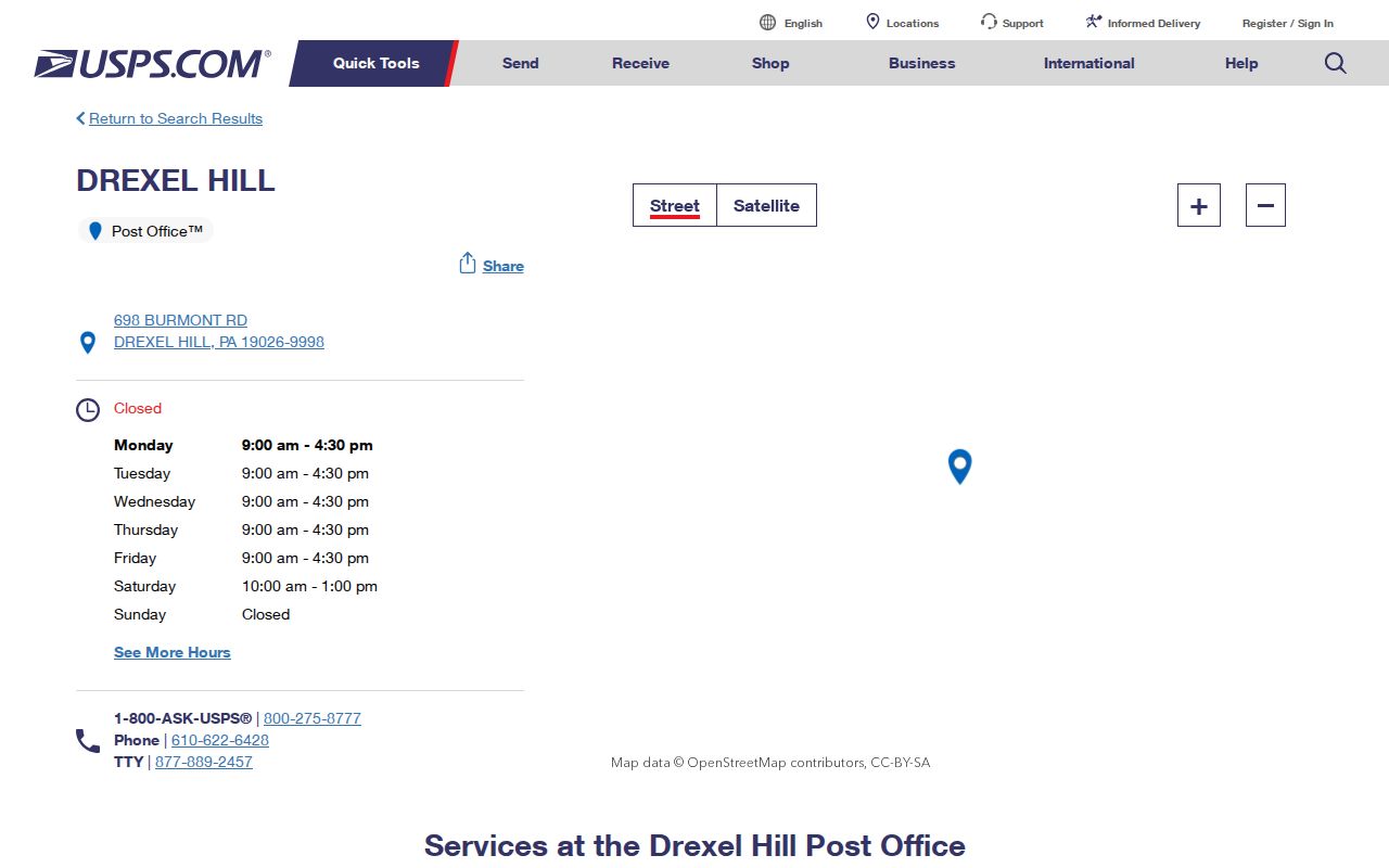
The image confirms a facility source, not an address-by-address coverage claim. For an actual record trail, verify the full delivery address and then keep the USPS result separate from the county parcel and tax fields.
Verify an Upper Darby Township Delivery Address
A postal label becomes useful only when it remains connected to the complete delivery address that produced it. The next steps join that address to a county record without claiming that a postal designation itself identifies a person, parcel boundary, or governmental district.
- Confirm the full USPS delivery address, including the postal city and the full ZIP or ZIP+4 when one is returned.
- Use the verified address in the Delaware County Real Estate Tax System to locate the displayed address and parcel identifier.
- Retain the tax system’s municipality and situs fields separately from the USPS-formatted delivery address. Record the access date for each source.
- If a particular recorded instrument is identified, search Cloud Search by its appropriate document, date, party, or municipality path, then inspect the image.
Use the full address rather than a street fragment or a postal designation alone. This research did not capture an official USPS address-level output for a particular Upper Darby parcel, so no parcel-specific postal result is claimed here.
Upper Darby Township ZIP Search Limits
No local records portal documented a ZIP-wide filter in the research. The county property system offers address, parcel, advanced, and map routes, but those options do not establish a postal-wide search. Recorder Cloud Search has document, party, date, OCR, book or page, and municipality paths, yet none is a documented postal filter.
| Official Route | Documented Search Fields | Postal-Wide Finding |
|---|---|---|
| County property system | Address, Parcel, Advanced, and Map Search. | No ZIP filter documented. |
| Recorder Cloud Search | Quick term and recorded date; advanced party, date, document, type, book/page, OCR, and municipality fields. | No ZIP filter documented. |
| Pennsylvania voter status | Individual registration-status route; exact live fields were not transcribed. | Not a verified bulk postal directory. |
When a person or property question has a complete address, the county record is the practical join. When no address is known, a postal designation does not replace a lawful election-record request or a current official individual-status check.
The voter-status service should be used only for the individual registration-status question it presents under the current state process. The research did not transcribe its exact live fields or verify a county bulk-order workflow. Avoid turning an absent result, a changed list status, or a shared postal label into a conclusion about a person.
Map Search does not convert the county system into a postal-boundary search. Delaware County Mapping provides mapping and data-request context, but the county describes its mapping information as informational and did not document a separate public GIS with verified adjacent-parcel controls. Verify each displayed parcel with the official record rather than drawing a coverage line from an unverified map behavior.
Upper Darby Township Parcel and Postal Fields
Postal and property systems use different identifiers. Preserve each string exactly as the source displays it. County tax materials show a dashed parcel example, 16-15-01234-56, while Recorder materials describe a form such as xx-xx-xxxxx-xx. Do not reformat either value or treat it as a substitute for a delivery address.
- ZIP code
- A mail-routing designation. It is not a township, parcel, election, neighborhood, or school boundary.
- ZIP+4
- An added delivery segment used with a full address. It refines postal delivery but does not identify county jurisdiction.
- PO box
- A mailing arrangement that can use a postal designation without describing a parcel situs.
- Parcel
- The county property identifier associated with a tax or mapping record. Its format and configuration can change over time.
- Municipal boundary
- The governmental jurisdiction identified through county or township sources, not through a postal label alone.
A legal description, parcel identifier, situs address, postal delivery address, and historic locality may all be relevant to the same record trail. Their relationship must come from a source, not from matching words or a shared postal designation.
Upper Darby Township Postal Labels and Jurisdiction
Upper Darby and Drexel Hill can appear as postal or community labels while the county parcel record identifies the governmental municipality. A postal boundary is not a municipal boundary, parcel boundary, voting district, neighborhood, or school-zone line. It should not be used to infer tax rate, election assignment, or local jurisdiction.
Older sources need a date as well as a label. A historic directory or map may use a postal community name that differs from a current county display. Preserve the source spelling, date, and field type, then mark the connection unresolved when there is no plan, original record, or other authority that bridges the labels.
Field rule. Keep postal city and ZIP, county municipality, parcel situs, historic locality, and source date in separate fields when they do not match.
Upper Darby Township Dated Record Trails
Postal context cannot replace the date-specific property trail. Delaware County says recorded-land history reaches to 1789, while online Recorder copies are described as 1799 to the present. The March 2024 Cloud Search announcement says the tool complements Fusion and includes public recorded-document search, historic scans, and Property Alert.
For an older address question, begin with the current parcel and then compare actual recorded images, plans, dated maps, assessments, archive material, and directory evidence in order. The County Archives has historical administrative series but excludes Recorder records. County Historic Maps provides context, not a present-day ownership finding. A source lower in that chain can suggest a lead, but it should not outweigh an original image that says otherwise.
Record the exact postal label and the source date at every stage. The County Archives preserves most administrative series roughly from 1789 to 1950, but its stated exclusion of Recorder records means a historic property trail may need both custodians. Do not overwrite an earlier locality or delivery label with the latest county display.
Upper Darby Township ZIP Boundary Limits
No authoritative complete Upper Darby Township-to-ZIP coverage table was located. The research also found no verified ZIP split or realignment date, and no official township-wide street-renumbering or predecessor-address crosswalk. Those gaps matter when a modern delivery label and an older record do not line up.
County Mapping and the township planning or License and Inspections channels are appropriate follow-up points for a defined address question. If a needed existing record is not posted, use a narrow Upper Darby Right-to-Know request or the relevant Delaware County open-records route, identifying the record series, dates, address or parcel, and preferred format.
The township says a regular open-records request receives a response within five business days, with a possible 30-day extension. A county request can be submitted through JustFOIA, but the county requires an identifiable requester, a U.S. resident, and a mailing address. Ask for a discrete existing record rather than a new directory or a reconstructed boundary line.
Note: A delayed, redacted, or no-record response does not prove that a postal label, parcel relation, or historic address never existed.